
DrillerDB Opens 10 Million Water Well Logs, 53 Million Rock Layers - Free for Researchers
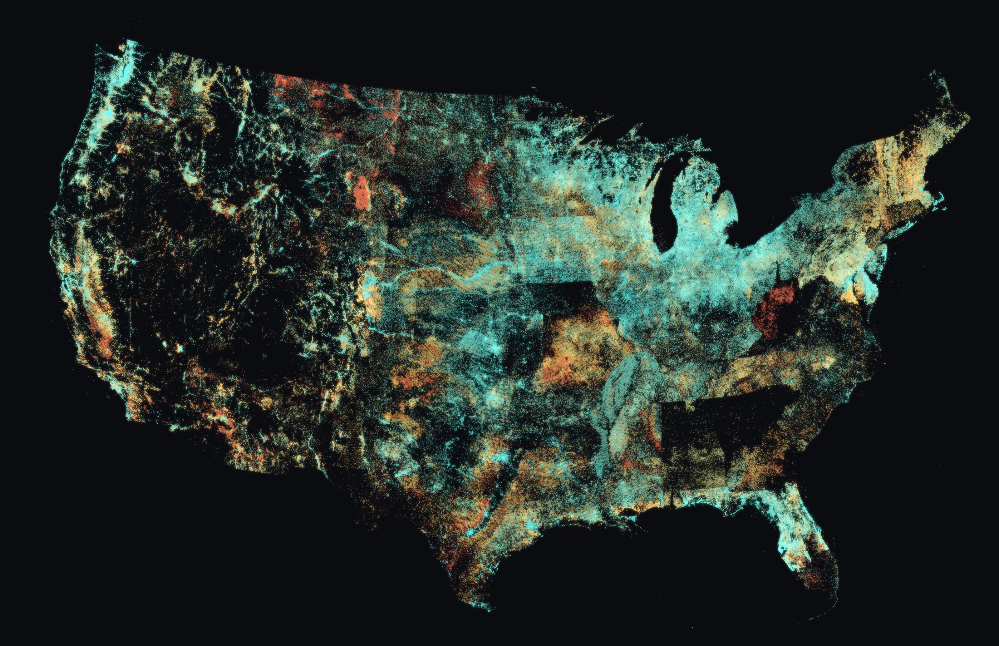
Nationwide view of our well depth dataset.
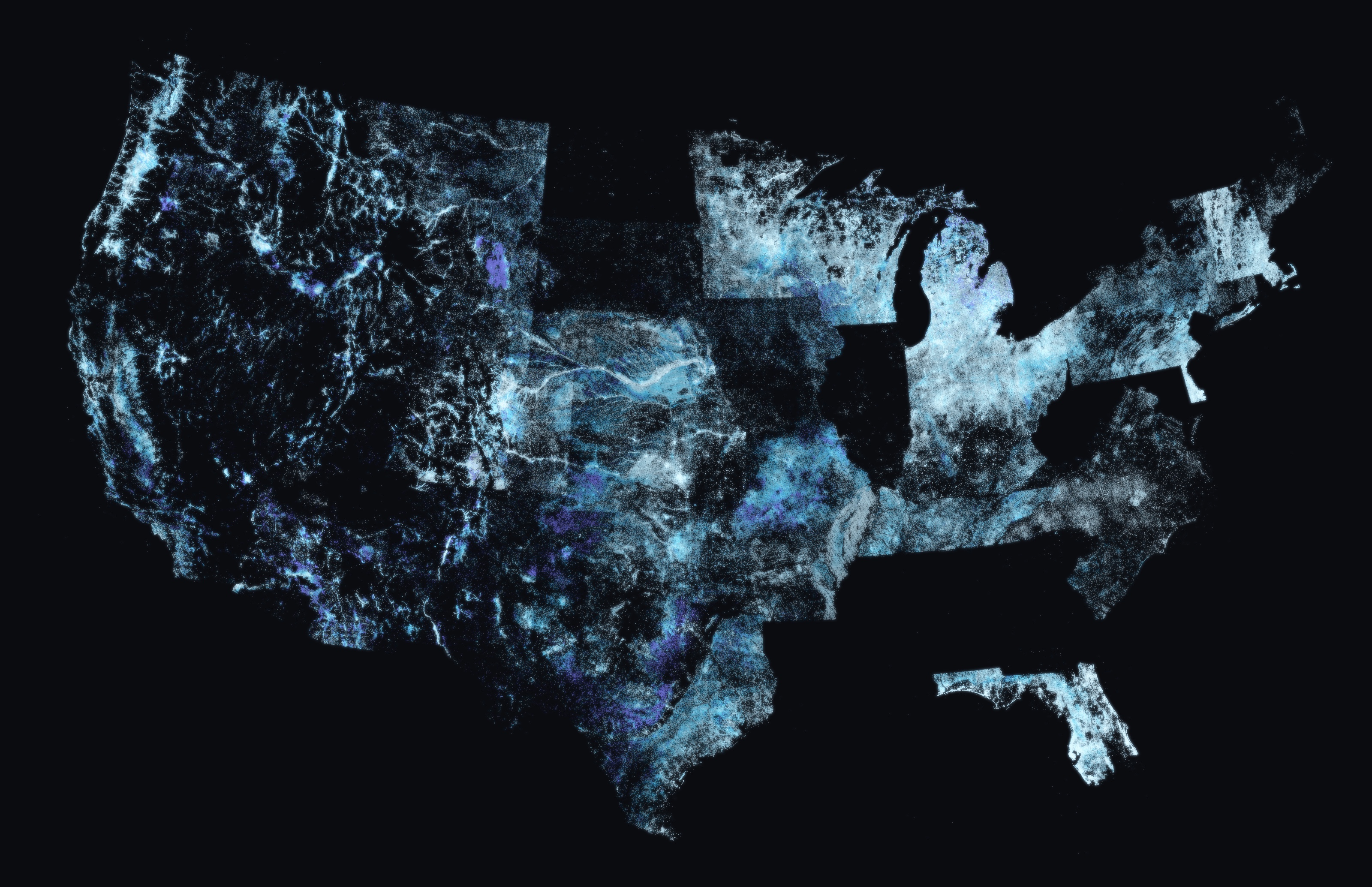
View of our water level dataset
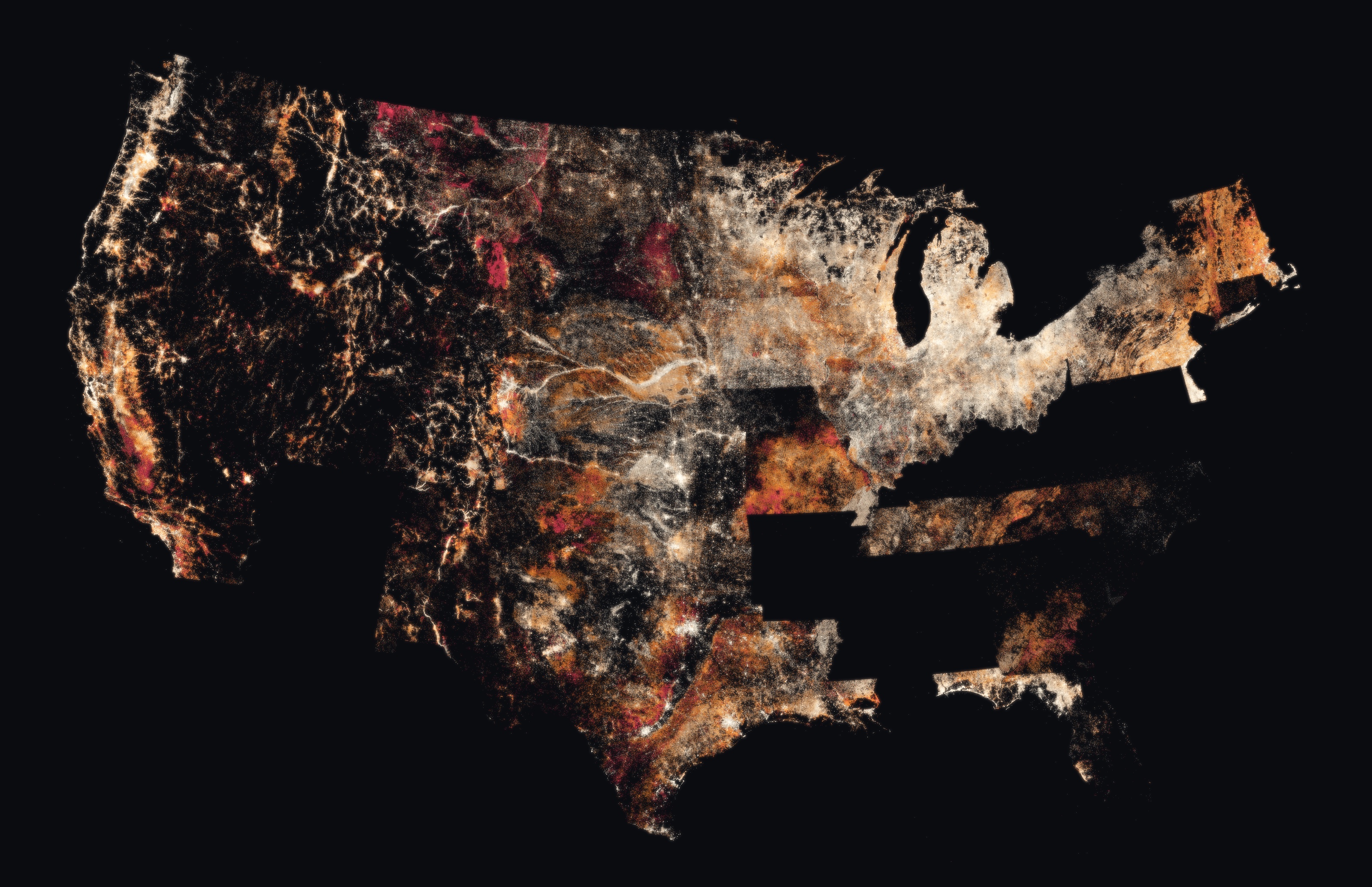
View of our standardized lithology dataset
The Underground Lithology Grid: North America's largest standardized well-log dataset, free for research. Colorado's new wells: 152 ft deeper than the 1970s.
Every time a water well is drilled, the driller records what the bit passed through - clay, sand, gravel, shale - and files that log with a state agency. Those logs are the only direct observational record of the shallow subsurface that exists at continental scale: the zone where drinking water wells, geothermal systems, and foundations live. State and provincial agencies have required, collected, digitized, and published them for decades; that preservation is why this dataset is possible at all. But a log written for Wisconsin's system was never meant to be read next to one from Kansas, and hundreds of thousands survive only as scanned handwriting.
DrillerDB processed more than 10 million of those logs and parsed more than 53 million individual depth intervals, assigning 51.3 million of them a lithology from a single controlled vocabulary. Where the driller recorded them, color and grain size are captured as separate fields. The original driller's wording is preserved alongside more than 99 percent of intervals, so every coding decision can be checked against the source. The result is the largest standardized, record-level compilation of driller-described subsurface lithology ever assembled for North America - roughly 33 times the size of the largest previously published compilation, the U.S. Geological Survey's 1.57-million-record glacial aquifer study (Bayless et al., 2017) - and the first to apply one lithologic vocabulary across state and provincial boundaries at continental scale. Anyone can see the mapped records for themselves - the interactive map at https://drillerdb.com/well-map is free and public.
The dataset is, in a literal sense, the accumulated field knowledge of the North American drilling trade: 14.5 million of the well records name the contractor who drilled the well, and more than 80,000 state-issued driller licenses appear across the dataset. The underlying logs are public records, filed under state law and released by the agencies that collect them. DrillerDB claims no ownership of any driller's log; what the company built is the translation layer that makes the records comparable across state lines.
"These are drillers' descriptions of what came up the hole. Hundreds of different ways to say the same thing, we've standardized them across North America. The original descriptions are still present for researcher comparison and can be referenced across the dataset." said Craig Vander Galien, founder of DrillerDB.
Standardization is overwhelmingly deterministic: 96.5 percent of intervals are coded by a curated, versioned dictionary rather than a language model, with under 1 percent AI-assigned and 1.7 percent left explicitly uncoded rather than guessed. In an independent audit of 1,000 randomly sampled coded intervals, the assigned lithology matched the driller's original description in 96 percent of cases, was judged partially correct in 3 percent, and outright wrong in fewer than 1 percent; the audit sample and methodology publish with the methods paper.
DrillerDB is equally explicit about what the dataset is not. Driller descriptions are made from cuttings at the rig, so depths carry uncertainty; terminology is not standardized to a laboratory scale; description detail concentrates in water-bearing zones; and wells are drilled where water is wanted, not on a scientific sampling grid. The federal government's own effort at this problem - the U.S. Geological Survey's National Water-Well Database, which has published Minnesota so far - is authoritative and deliberately careful, state by state; the Grid is broad and immediate, and the two answer different questions.
Researchers can apply for free record-level access under a one-page data use agreement at https://drillerdb.com/research. The program is built for water research of every kind: groundwater levels and long-term water-level trends, water scarcity and drought response, well depth and construction trends, groundwater development and supply planning, aquifer characterization, geothermal siting, and public health for the more than 40 million Americans who rely on private wells.
"This dataset is a first of its kind as assembling this across state lines was something no single agency was ever chartered to do, we decided to take it up for our customers and the research community. After months of work it's finally finished.. We would rather see this drive research than sit in our database," Vander Galien said.
About DrillerDB
DrillerDB (https://drillerdb.com) builds business management software for water well drilling contractors and maintains the largest databases of water well records in North America - more than 18 million records across the United States and Canada. The public can explore the records on the interactive well map (https://drillerdb.com/well-map), find licensed contractors at https://drillerdb.com/find-drillers, and preview expected geology for any US location with the Geology Estimator (https://drillerdb.com/geology/estimator). Founded 2024; based in Chicago, Illinois.
Press kit (logos, high-resolution maps, fact sheet, photos): https://drillerdb.com/news/press-kit
Craig Vander Galien
DrillerDB
+1 920-296-3999
email us here
Visit us on social media:
LinkedIn
Facebook
X
The Underground Lithology Grid: 53 Million Rock Layers, One Vocabulary
Legal Disclaimer:
EIN Presswire provides this news content "as is" without warranty of any kind. We do not accept any responsibility or liability for the accuracy, content, images, videos, licenses, completeness, legality, or reliability of the information contained in this article. If you have any complaints or copyright issues related to this article, kindly contact the author above.
